
All About the Missouri River
(from the perspective of one paddler who is planning to paddle it)
Note: this is about the physical characteristics of the river, not about it’s history
by Scott Miller
Every year a small number of people make an attempt to through-paddle the Missouri River. The home base for Missouri River paddlers is the Missouri River Paddlers website and Facebook group, filled with tons of excellent information, photos, videos and trip reports, all compiled and kept up to date by expedition paddler, historian, writer and photographer Norman Miller, who paddled the river in 2004 during the Lewis & Clark bicentennial.
Having myself paddled the length of the Mississippi River, choosing the Missouri River for the next adventure is alluring because it is in some ways similar to the Mississippi, yet in many other ways very different. It is similar in that it’s essentially the same length, though most sources give the edge to the Missouri, citing it as the longest river in the nation at 2,341 miles (sources have the Mississippi between 2,250 and 2,340)1.
The contrast between the Mississippi and the Missouri rivers is dramatic. The Mississippi arises in a land of boreal forest and lakes in northern Minnesota; the Missouri takes shape in the soaring mountains of Montana. The Mississippi flows through a land that gets plenty of rain and is filled with green trees; the Missouri flows through a semi-arid land of bluffs, prairies, and wind-swept badlands. The Mississippi flows in or along ten states; the Missouri, seven. The Mississippi flows through two state capitals (St. Paul, Minnesota and Baton Rouge, Louisiana). The Missouri flows through three (Bismarck, North Dakota, Pierre, South Dakota and Jefferson City, Missouri)2.
The Missouri starts near the town of Three Forks, Montana, where three rivers come together. It officially starts at the confluence of the Jefferson and Madison in Missouri Headwaters State Park. The “third fork”, the Gallatin river, joins the Missouri a mile downstream. The Jefferson, Madison and Gallatin all carry water down from high elevations in the mountains. The Missouri headwaters are surrounded by mountain ranges. As one heads downstream, the Elkhorns and the Big Belts draw near. 83.5 river miles downstream from the headwaters is a five-mile long stretch named by Lewis and Clark as “the Gates of the Mountains”, where mountains arise on both sides of the river, welcoming the upstream travelers to the Rocky Mountains. The river continues past the peaks of the Lewis and Clark then through the Adel mountains before reaching flatter land.
As wild and remote as the Missouri river often is, it’s also impeded by fifteen dams, the first of which, Toston, appears just 22 miles downstream from the headwaters. These dams create wide areas of flatwater with no current, referred to variously as pools, lakes or reservoirs. At first these slackwater areas aren’t terribly large, and the river still mostly looks and acts like a river. 202 miles from the headwaters the river reaches the first city on the Missouri–Great Falls, where it drops over the Great Falls of the Missouri, a series of five substantial waterfalls. Merriweather Lewis called it the “grandest sight I ever beheld”. Nowadays the falls have mostly been submerged by five dams, with Crooked Falls being the only one that remains in its natural state. For a through paddler, this stretch calls for a brutal 18 mile portage. We hope to do it in 12 hours, which would be a significant improvement over the time it took the Lewis and Clarks’ Corps of Discovery: 31 days!
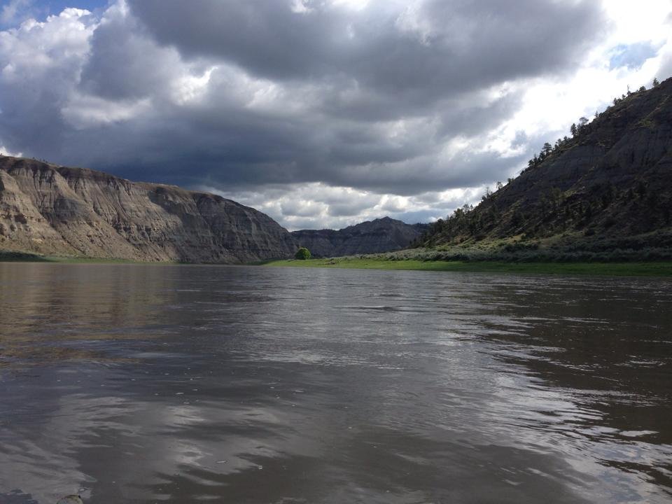
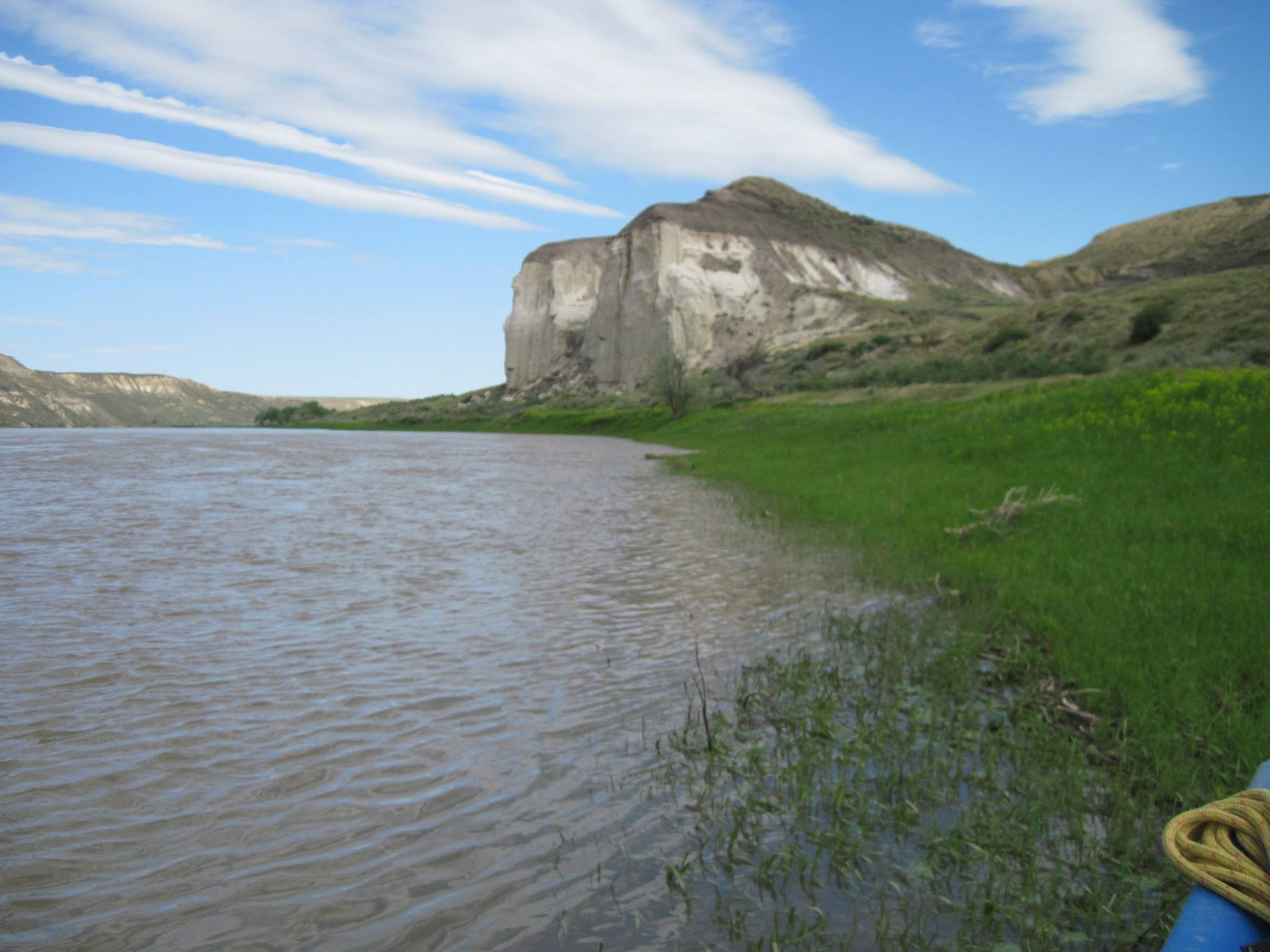
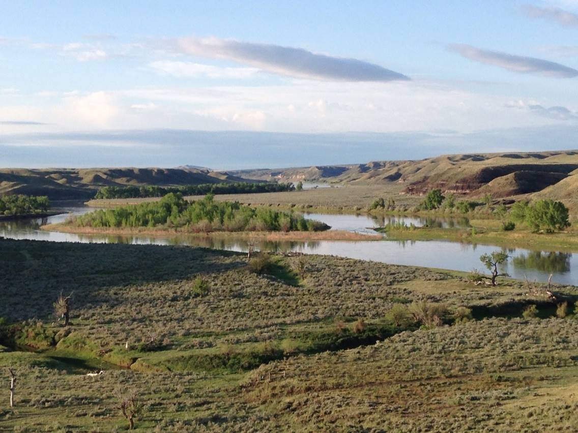
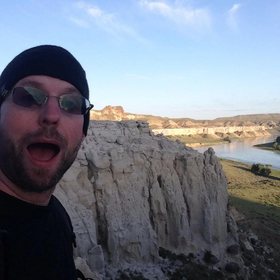
For a guy from the mountain-less lands of Minnesota, you’d think the most exciting scenery on the Missouri would be the mountains, however after passing through Great Falls the Missouri flows through an equally beguiling landscape: the Missouri Breaks: 150 miles of remote canyons and badlands with just a single bridge crossing3. Here the river is designated as a national wild and scenic river, and protected as a national monument. This is a land where mule deer, elk, antelope, rattlesnakes, prairie dogs and bighorn sheep all live. There are many-colored bluffs (including the famous ‘White Cliffs’), soaring arches, and rock formations of many shapes.
Soon after the Missouri Breaks, the river reaches the first of six massive reservoirs created by six dams, all controlled by the US Army Corps of Engineers (ACE). Unlike on the Mississippi, these dams have no locks, so the through-paddler must portage.
All told there’s dramatically more flatwater on the Missouri than the Mississippi, at least 850 miles of it, creating a significant challenge to any paddlers. Massive prairie electrical and wind storms are common and can quickly whip these huge bodies of water into a frenzy of waves large enough to make all boat traffic impossible. Without the aid of any current, we expect that the approximately 35% of the river that is flatwater will take about 50% of our time; more if the weather is bad.
The first of the big six reservoirs is Fort Peck Lake, wild, rugged, windy and remote–134 miles long and with 1,520 miles of shoreline. Continuing east into North Dakota, the Missouri is joined by the Yellowstone4 before flowing into 178 mile-long Lake Sakakawea. The river’s predominant direction changes from east to south, and it flows 77 miles, through Bismarck, before reaching the biggest and longest reservoir of them all–Lake Oahe. 231 miles long, about ⅓ of Oahe lies in North Dakota, and ⅔ in South Dakota. Oahe has 2,250 miles of shoreline–most of it barren and rugged and with summertime temperatures easily reaching a scorching 100 degrees.
After Oahe, riverine segments alternate with the final three reservoirs. After flowing past Pierre, the river flows through 85-mile long Lake Sharp, followed by 107-mile long Lake Francis Case and, finally, 25 mile-long Lewis and Clark Lake. After the Gavins Point Dam, the river flows unimpeded for 732 miles to the Mississippi, soon reaching the South Dakota/Nebraska border and flowing through a 59-mile segment listed on the National Register of Wild and Scenic Rivers.. At Sioux City, Iowa the river changes character and flows south, marking the Nebraska/Iowa border. For the first time, the river is marked with buoys and a channel is maintained for barge traffic. The barge traffic on the Missouri is however vastly less in number, with smaller loads than those found on the lower Mississippi, which is a source of great comfort to me, having had too many traumatic interactions with those hulking behemoths and their massive 12-foot haystack-wave spawning wakes.
The river flows 105 miles from Sioux City to Omaha, then nearly 260 miles from Omaha to Kansas City, with Iowa first giving away to Missouri on the left bank and then Nebraska giving away to Kansas on the right.
Once at Kansas City the river flows east across Missouri. The confluence with the Kansas, or Kaw, river in Kansas City is where the famous Missouri River 340 Paddle Race begins. By this time the arid sweeps of the Dakotas are long gone, replaced with a verdant forested valley on both banks, and some still impressive bluffs. The 340 mile section includes Jefferson City and ends at St. Charles; from which just 30 miles or so remains to bring one to the confluence with the Mississippi and, a few miles downstream from there, the famous St. Louis Arch.
Notes:
It is astonishing how, in our modern internet age, it is still hard to find a definitive length for both the Mississippi and Missouri rivers. You can find many confident sources giving different answers, and even different opinions on which river is longer (though if the Jefferson River was considered part of the Missouri then there’d be no question the Missouri is longer). Also interesting is that although one might think that one name would be given to the longest waterway within any given watershed, that doesn’t always happen and indeed is not the case for the watershed that includes both the Missouri and Mississippi rivers. The longest waterway within the Missouri/Mississippi watershed is the combined course of the entire Missouri River along with the Mississippi below where the Missouri joins it. That combined waterway is approximately 3,710 miles, the 4th longest waterway in the world.
Helena, the capital of Montana, is near the Missouri, but not on it, thought it certainly flows through what can be called “the Helena metropolitan area”
There are two places where vehicle ferries still operate (and a third upstream from the Breaks).
The Missouri’s single biggest tributary.